Route – GPX file
The full route as a GPX file, for bike computers (Garmin, Wahoo, Hammerhead) and apps like Komoot, Strava and RideWithGPS.
Download GPXEverything you need to plan and navigate The Brunel Way.
The full route as a GPX file, for bike computers (Garmin, Wahoo, Hammerhead) and apps like Komoot, Strava and RideWithGPS.
Download GPXThe full route as a KML file, suitable for Google Maps and Google Earth.
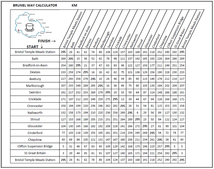
Download KMLAn image of the route distances between towns and cities, in kilometres.
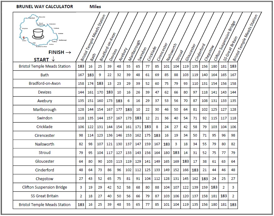
Download imageAn image of the route distances between towns and cities, in miles.
Download imageOn a phone, GPX files usually save to your Downloads folder. Open them from there with your navigation app, or import them via the app's website on a computer.